The Georgian Military road has been known since ancient times, as it is one of only two routes through the Greater Caucasus range.
In his essay on Iberia, the ancient Roman geographer Strabo notes that this path is very difficult and dangerous, as the traveler must climb to the peaks along narrow trails where even two people cannot pass each other, and the road ends at an impregnable wall.
This wall with a gate is also mentioned by Pliny in his Natural History (around 77 BC).
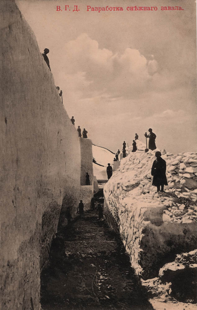
Glaciers descending from the summit of mount Kazbek are the cause of landslides on the Georgian Military road.
The most dangerous of Kazbek’s eight glaciers is the Devdorak Glacier.
It was the Devdorak Glacier that brought down the famous Yermolov rock, which still lies near the village of Verkhny Lars.
Its length is about 30 meters, width 17 meters, and height 15 meters. The volume of the boulder is about 6,000 cubic meters, and it weighs approximately 15,000 tons.
On August 12, 1832, such a mass of snow, ice, and rocks fell from the mountains that it buried the bottom of the gorge for a length of two versts (2.1 km) and to a height of 50 sazhens (100 meters).
The Terek river temporarily stopped its flow, forming a large lake above the landslide, and near Vladikavkaz people crossed the river on foot.
This fallen mass of ice and snow blocked the road for two years, people crossed it on foot using steps cut in the snow.
